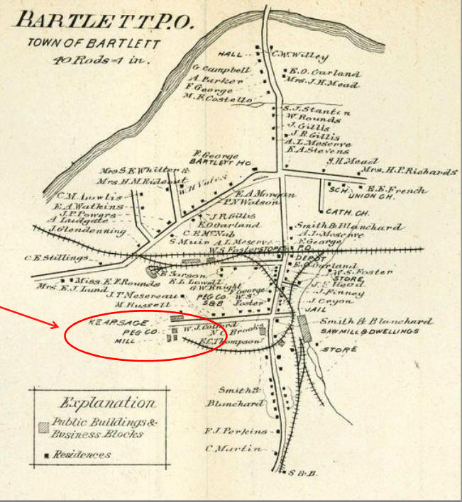
LATE 1800's MAP OF BARTLETT VILLAGE AREA AT LEFT:
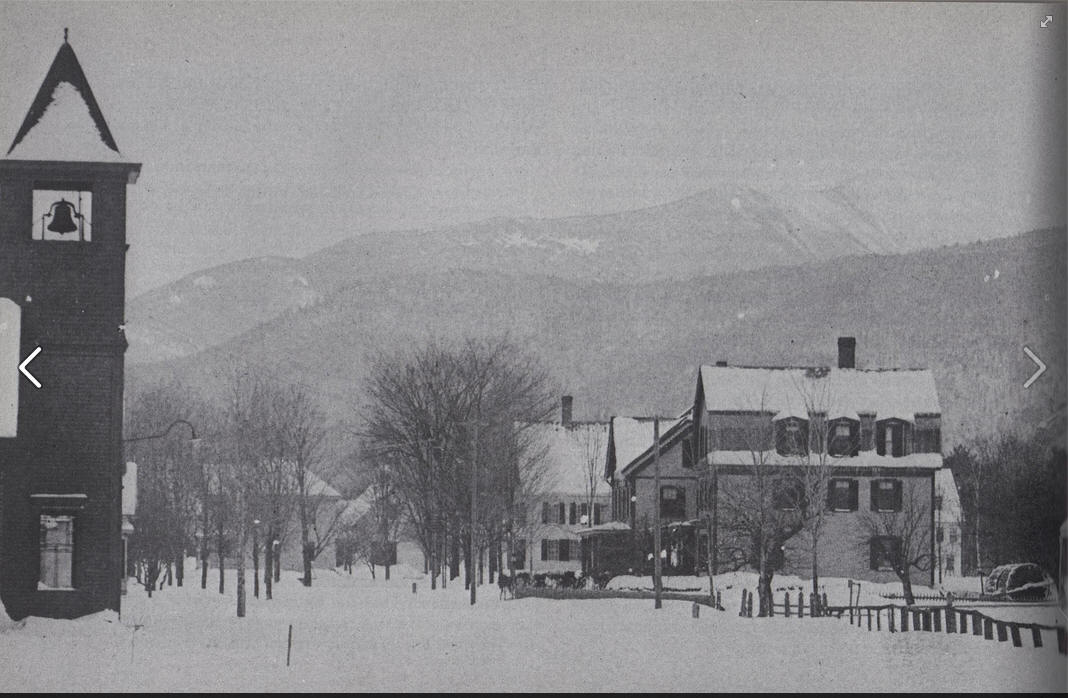
We are trying to determine the location of the photograph below.
Original thoughts were that it was taken from somewhere just east of the
present day post office.
But,
But, the steeple with the the bell appears to be a church and we find no
record of a church in that location. However the map at left shows the
"Union Church", next door to the school. Its location matches the
description found in Aileen Carroll's history book "Bartlett New Hampshire,
in the Valley of the Saco".
The Cave Mountain House/Bartlett Hotel was built in 1890 and since it is not
shown on the map we can assume the map is before that time.
But, The St. Josephs Catholic Church IS shown and it was built in 1890.
Nov 2013: We think the mystery is
solved:
So, imagine this photograph (below) without the need to place a big hotel in
the scene, (since it had not been built yet) then this viewpoint is taken from just east of the
present day school, with the Union Church on lower main street near the
school?.
The first house on the right would be that of Mrs. H.P. Richards, then the
S.H. Mead house and Frank Georges Bartlett House Inn in the background
center? That would match the map.
(The Union Congregational Church was not built until 1896). The church
in the photograph (The Union Church) was moved across the street and converted to a
private residence.
Scotty Mallett confirms this information,
"According to my father, this used to be a bungalow style church across from the school. The bell tower was removed and what was left was incorporated into the house. Dad says it was Jim Donahues bungalow later to become my mom and Dads first home after they got married. The wrap around porch was added before my parents got it. The house still stands today, it is across from the school and is white in color."
Keep in mind that over the course of 120 years there would have been fires
and other calamities, so some of the building shown may have disappeared
long ago.
Vere Royse and Thomas Chadbourne; Original Grantees of Upper Bartlett and
Harts Location
I recognize Ralph Clemons, Tony Schultze, Tom Kennedy, Cindy Garland,
Michael Chandler, Burkes, Marcouxs, Eliason brothers, Mary Jane Davis (her
Mom was the Principal), Dean Creps,
THIS INFO HAS BEEN UPDATED HERE
I
f you were in the Bartlett Elementary School sometime
_small.jpg)
around 1958 you may find yourself in this picture.
Click on it for a size you can
actually see. Diane Dudley Osborne told me what the event was, but I don't
remember now what she told me. Maybe it was Halloween.
.jpg)